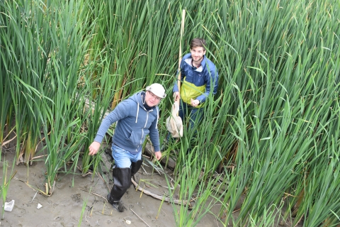


Research at the Great Lakes Center focuses on the ecology and ecosystems of the Great Lakes and their tributaries. GLC research scientists, affiliates at Buffalo State University, and collaborators from other institutions bring diverse areas of expertise to the Great Lakes. Such expertise enables scientists to provide policymakers with information, which in turn promotes more informed decisions about ways to protect water quality, support the survival of native species, manage nuisance invasive species, monitor carcinogens in the food web, and many more. Research also contributes to scientific understanding of the complex interactions that occur in aquatic ecosystems around the world.
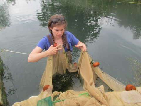
Monitoring of benthic invertebrates in the Great Lakes
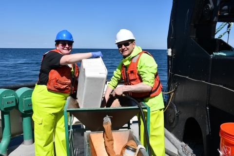
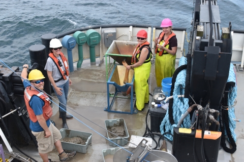
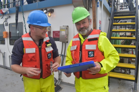
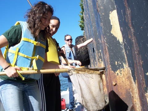
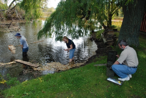
The EPA Great Lakes National Program Office (GLNPO) Biology Monitoring Program is designed to provide managers access to biological data on zooplankton and benthos to support decision-making. In collaboration with Cornell University, we collect benthos (Buffalo State), zooplankton, and chlorophyll data (Cornell University) across the five Great Lakes, analyze this data, and make it available to environmental and fisheries managers. In addition to an annual survey of 57 long-term stations, a much more detailed survey is conducted on each lake every 5 years with the Coordinated Science and Monitoring Initiative (CSMI). We participated in CSMI surveys in 2014 (Lake Erie), 2015 (Lake Michigan), 2016 (Lake Superior), 2017 (Lake Huron), 2018 (Lake Ontario), 2019 (Lake Erie), 2021 (Lake Michigan), 2022 (Lake Huron and Lake Superior), and 2023 (Lake Ontario). Additional research projects include impact of dreissenids on the lower food web and benthic nepheloid layer, and development of remote sensing methods.
We identified benthic samples collected onboard the EPA R/V Lake Guardian from all the Great Lakes in 2012–2024 and submitted the data to GLNPO. These data are the basis for individual lake reports as well as reports for the State of the Great Lakes. Thus far, the results of the study have been published in over 35 papers, 15 reports, and were presented at regional and international meetings.
Seventeen years of GLNPO Biology Monitoring Program benthic data were analyzed by Burlakova et al. (Burlakova et al., 2018) to reveal temporal and spatial trends in benthic community structure across the lakes. In 2018, we published a Special Issue containing 18 papers in the Journal of Great Lake Research (“U.S. EPA GLNPO Long-Term Monitoring of the Laurentian Great Lakes: Approaches, achievements and lessons learned,” Eds. Burlakova, L., A. Karatayev, L. Rudstam, and E. Hinchey). Some of the publications and reports of the 2014-2021 CSMI benthic surveys are available in Publications.
Check out this video of a nighttime ponar grab, taken during August 2013 while our researchers were aboard the R/V Lake Guardian. (Video credit: US EPA.)
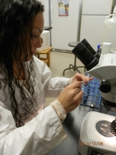
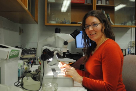
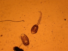
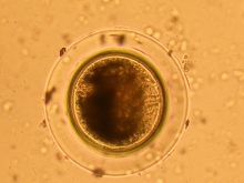
Great Lakes Benthic Invertebrate Guide
Using the data and images from the EPA Long-term Biological Monitoring Program, CSMI, and DNA Barcode Reference Library project, we are creating a digital reference guide to the benthic species found in the Great Lakes.
New method for rapid assessment of dreissenid mussel populations
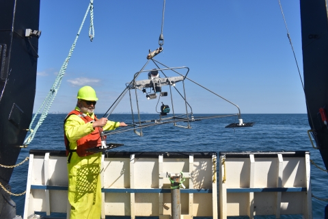
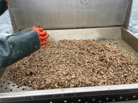
The Great Lakes Center, in collaboration with the U.S. EPA’s Great Lakes Biology Monitoring Program and Office of Research and Development-Great Lakes Toxicology and Ecology Division, has developed a new method for rapid assessment of dreissenid mussel populations in lakes. The method uses a Benthic Imaging System (BIS) to estimate population size of these invaders in near-real time during a typical 2-week summer cruise of the EPA research vessel Lake Guardian. The BIS consists of Go-Pro cameras and lights mounted to a steel frame that is lowered to the lakebed from a ship. The resulting bottom images are analyzed via imaging software to estimate mussel density and percent coverage. The new method substantially reduces the time required to map distributions of dreissenid mussels across large spatial scales compared to traditional sediment collection methods. This increase in spatial resolution and reporting times of monitoring is especially important considering that the quagga mussel is now now one of the major drivers of the ecosystem processes in the lower four Great Lakes. This method for Dreissena rapid assessment was applied in Lake Erie in 2019, Lake Michigan in 2021, Lake Huron in 2022, Lake Ontario in 2023, and Lake Erie in 2024, and will be applied in future surveys as a valuable addition to conventional bottom grab monitoring. Results of these studies were already published in two papers and presented at multiple international meetings. This method is now used for quagga mussel monitoring in deep Swiss lakes Constance and Biel (Haltiner et al., 2022). The research paper Rapid assessment of Dreissena population in Lake Erie using underwater videography is published online with @SpringerNature in Hydrobiologia.
News articles: Newsletter #14: GLC hosted CSMI 2019 Lake Erie workshop; Newsletter #15: GLC hosts scholars from Poland; Newsletter #15: CSMI Lake Erie Survey 2019; Great Lakes Center, EPA Collaborate on New Imaging Tool; Great Lakes Restoration: "New method for rapid assessment of quagga and zebra mussel populations"; Newsletter #16: CSMI 2020 Lake Michigan workshop; Newsletter #18: Planning summer 2021 benthic surveys in Lakes Michigan and Superior; Newsletter #19: The GLC returns to the R/V Lake Guardian; Newsletter #19: Lake Michigan benthos sampling; Newsletter #20: Great Lakes Center continues monitoring benthos of all Great Lakes; Newsletter #20: State of Lake Erie meeting; Newsletter #21: CSMI Lake Huron survey on Canadian boat; Newsletter #23: Benthic Palooza in Lake Ontario; Newsletter #24: Use of videography to assess round goby densities in the Great Lakes; Newsletter #24: The New Zealand mud snail newly detected in Lake Huron; Newsletter #25: Exploring Lake Erie: Great Lakes scientists conduct CSMI survey; Newsletter #27: Exploring Lake Michigan: Great Lakes scientists conduct CSMI survey
Benthoscapes
Images from side-looking Benthic Imaging System (BIS) cameras used for rapid assessment of dreissenid populations during CSMI surveys are also used to assess spatial distribution of benthos and Mysis. Communities of benthic macroinvertebrates are among the most useful indicators for biological assessment of environmental and anthropogenic stressors, but both sample processing and species identification are time-intensive, often requiring several years to identify all samples from a large-scale survey. Mapping benthic landscape or “benthoscape” structure and dynamics using underwater video can provide valuable and cost-effective assessment of bottom habitats on large spatial scales with minimal habitat disturbance.
In 2019, during the CSMI benthic survey in Lake Erie, we used this approach to characterize benthic habitats, and then tested whether visual classification could serve as an indicator of hypoxia (Burlakova et al., 2023). We identified four habitat types that differed significantly in near-bottom dissolved oxygen concentration and confirmed that video analysis can provide a quick and reliable method to detect habitats affected by periodic hypoxia. Video identification of benthoscapes may be important for regional monitoring of over 20 hypoxic zones documented in the Great Lakes where the extent and magnitude of hypoxia currently represent a major knowledge gap. We used this method to detect hypoxic habitats in 2022 on Saginaw Bay of Lake Huron, and in 2023 on Hamilton Bay of Lake Ontario. The results of this study have been recently published in Ecological Indicators.
New articles: Newsletter #15: CSMI Lake Erie Survey 2019; Great Lakes Center, EPA Collaborate on New Imaging Tool; Great Lakes Restoration: "New method for rapid assessment of quagga and zebra mussel populations"; Newsletter #21: CSMI Lake Huron survey on Canadian boat; Newsletter #23: Sampling Hamilton Harbor
Benthos of the Laurentian Great Lakes: Inventory of lake-wide surveys
Over 110 lake-wide benthic surveys were conducted on the Laurentian Great Lakes since 1929. However, these studies often are not readily available, and have never been combined in one dataset to preserve historic data. According to our estimations, primary data for at least 20% of all surveys are incomplete or have already been lost. For over four years, the Great Lakes Center has been conducting an inventory of benthic surveys for all the Great Lakes to create a database with all the available information on species composition, distribution, density, and biomass of benthic invertebrates. Considering the rarity of long-term benthic studies in lake ecosystems, this data set could be useful to explore effects of different environmental factors and exotic species on community organization, and for monitoring of water quality, biodiversity, exotic species introduction, fish food base assessment, and other ecosystem services provided by benthic community. Our first complete dataset on the Lake Ontario benthic community includes taxonomic data to the species level for 11 of the surveys and data to the group level for another two surveys covering the last 54 years, and was published as a data paper in Ecology (Burlakova et al., 2022). Our second paper summarizing 90 years of benthic research in Lake Erie has been recently published in the Journal of Great Lakes Research and the database in Ecology as a data paper. The paper describing long-term changes in Lake Superior benthic community is currently in review in the Journal of Great Lakes Research. Currently we are analyzing data from benthic research conducted in Lake Huron.
News articles: Newsletter #18: Long-term benthic data revealed large changes in Lake Ontario ecosystem
Interactions of benthic invertebrates with the Benthic Nepheloid Layer
Benthic nepheloid layers (BNLs) are areas of high turbidity and suspended solids that form near the benthos during summer stratification. BNLs can be several meters thick and are common in the Great Lakes. The suspended sediment and other material that build BNLs can come from a variety of sources, including sediment resuspension, entrainment of spring runoff in the hypolimnion, settling of particles from the epilimnion, and from density currents. We analyzed GLNPO long-term data to examine relationships between BNL intensity/thickness and benthic invertebrate production, and to compare current BNL intensity and thickness to historical data from studies prior to Dreissena invasion. We found that prior to the appearance of Dreissena, pronounced benthic nepheloid layers were a consistent and extensive feature of the offshore, stratified waters of all the Laurentian Great Lakes, except Lake Superior. In recent (2010–2019) years, the BNL has disappeared from all areas except for central Lake Erie, where only a small decrease in bottom turbidity has occurred. All stratified regions which exhibited a pre-Dreissena BNL, including central Lake Erie, experienced substantial post-Dreissena reductions in near-bottom total phosphorous. These post-invasion reductions in bottom phosphorus during the stratified season could be contributing to the offshore oligotrophication of Great Lakes and to changes in benthic populations, most notably the dramatic decline in deepwater amphipod Diporeia. The manuscript based on this study (“The benthic nepheloid layer in the offshore waters of the Great Lakes and its post-dreissenid disappearance” by R. Barbiero, L. Burlakova, J. Watkins, A. Karatayev, and B. Lesht) was published in the Journal of Great Lakes Research and received the Chandler-Misener Award as “most notable” paper based on originality, contribution, and presentation (IAGLR announces journal, editor awards).
News articles: Great Lakes Seminar - 'The Benthic Nepheloid Layer in the Great Lakes: What Is It, and Where Did It Go?' - November 17; IAGLR announces journal, editor awards; Achievements: Lyubov Burlakova, Senior Research Scientist, and Alexander Karatayev, Director, Great Lakes Center
Eutrophication and multiple invasions decimate the most imperiled freshwater invertebrates
This is a collaborative project with scientists from Cornell University, and Maryland University College Park. We analyzed species composition and density of molluscs in Oneida Lake (New York, USA) for over a century. At the beginning of the 20th century, the lake was in a clear water phase and hosted a very diverse molluscan community. Eutrophication that peaked in 1970s resulted in 25% decline in species richness and 95% decline of the density of native gastropods. Introduction of zebra and quagga mussels was associated with an increase in water clarity and the expansion of macrophyte and bottom algae resulting in the sharp increase in species richness and the density of native gastropods by 2012 but caused a complete extirpation of unionids by 1995. Introduction of round gobies in 2013 was associated with the significant decline across all gastropod families, but the strongest impact was recorded for the soft-shelled snails. Gobies impact was also depth- and time-dependent. Deep areas were less affected, and most molluscs experienced at least partial recovery. This paper was published in Biological Invasions in early 2025.
News articles: Newsletter #21: Molluscs of Oneida Lake; Newsletter #26: Molluscs through time: Oneida Lake's 100-year ecological journey
BODENSEE in STRESS - Modelling the consequences of climate change and invasive species for the Lake Constance ecosystem as a basis for integral management: The impact of serial invasion of dreissenids on lake ecosystems
This is a large collaborative project involving over 15 scientists from multiple institutions in North America and Europe. Within this project we synthesized decadal time series across seven lake ecosystems to resolve shared changes in seven key ecosystem features following invasion by zebra mussels and subsequent invasion by quagga mussels. These two congeners are among the most widespread invasive species that re-engineer and increasingly co-invade freshwater ecosystems. Seven polymictic shallow lakes with long-term data sets revealed remarkably similar trends, with the strongest ecosystem impacts occurring within 5-10 years of zebra mussel invasion. Surprisingly, plankton communities then exhibited a partial, significant recovery. This recovery was absent, and impacts of initial invasion amplified, in four lakes were quagga mussels outcompeted zebra mussels and more completely depleted phytoplankton. Recently we added data on deep stratified lakes to address the following hypotheses: (1) In stratified lakes quagga mussels form higher lake-wide density than zebra mussels and therefore their ecosystem impact will be stronger. Alternatively, as the bulk of quagga mussel population in stratified lake is located below thermocline and is isolated from the surface waters for most of the growing season, their impact on planktonic communities may be lower than zebra mussels, while profundal benthic community may be more strongly affected by quagga mussels. (2) In contrast to polymictic lakes, in stratified lakes it takes much longer for quagga mussels to reach population maximum and therefore the maximum ecosystem impacts will be delayed. In November 2024 – April 2025, while on sabbatical in the Swiss Federal Institute of Aquatic Science and Technology within “BODENSEE in STRESS” collaborative project, we collected more data from stratified lakes in Germany, Switzerland, and France and are currently analyzing the trends.
News articles: Newsletter #22: Times scales of ecosystem impacts and recovery under individual and serial invasions; Newsletter #24: Collaboration on quagga mussel study in Europe; Achievements: Lyubov Burlakova, Senior Research Scientist, and Alexander Karatayev, Director, Great Lakes Center; Newsletter #26: Working in Switzerland; Newsletter #26: Photos from sabbatical
Partnership for Regional Invasive Species Management
The Western New York Partnership for Regional Invasive Species Management (WNY PRISM) works to address invasive species priorities using a coordinated partnership for which we provide leadership, technical assistance, and opportunities for collaboration. Our goal is to improve, restore, and protect local aquatic and terrestrial resources by improving the effectiveness of invasive species management efforts, engaging the public in management actions, and increasing awareness of invasive species issues throughout the eight-county Western New York region. To achieve established goals, WNY PRISM coordinates several high profile and priority programs that address all aspects of the invasive species management needs of the region by forming strategic partnerships, developing resources and increasing regional capacity. WNY PRISM runs a robust Early Detection and Response Program, several Community Science Programs (Trail Survey, Hemlock Woolly Adelgid Hunters/Stand Assessments, Spotted Lanternfly Trap Monitoring), a Crew Assistance Program that sees WNY PRISM work with dozens of partners across the region each year, and a Watercraft Inspection Stewardship Program with up to 15 Boat Stewards. This is in addition to expansive education and outreach, data collection, and information management efforts. For more information WNY PRISM activities and results, you can find our Annual Report at www.wnyprism.org.
News articles: SUNY Buffalo State Receives $1.1 Million Grant for Invasive Species Management; Newsletter #2: Growing the Great Lakes Center; Newsletter #2: PRISM on the Move; Newsletter #2: Invasive species of note; Newsletter #3: In the news; Invasive Species Management Office Opened, Coordinator Named; Newsletter #4: Growing the Great Lakes Center; Newsletter #4: Early detection, rapid response key to controlling invasives; New York Invasive Species Awareness Week; WNY PRISM coordinator interviewed on WGRZ for Invasive Species Awareness Week; Buffalo State Experts: Invasive Species Management; Newsletter #5: A summer of education, outreach and invasive species management; Newsletter #5: In Other News...; Newsletter #5: Invasive Species Spotlight: Pale Swallow-wort (Cynanchum rossicum); WNY PRISM Provides Education, Outreach, and Invasive Species Management; WNY PRISM newsletter released; WNY PRISM Plans Invasive Species Awareness Week Activities; Newsletter #7: Chautauqua Lake outlet survey; Newsletter #7: WNY PRISM collects purple loosestrife beetles; WNY PRISM Tackles Land, Water Invaders; Newsletter #9: Early detection protocol for invasive species in Western New York; Invasive Species Awareness Week: What's Wrong with Honeysuckle?; Newsletter #11: Integrated Pest Management; Newsletter #12: Invasive species spotlight: Slender false brome; Newsletter #12: WNY PRISM continues to grow; Newsletter #13: WNY PRISM refunded for 5 years; Pennuto Awarded PRISM Grant; Newsletter #14: Introducing WNY PRISM's expanded watercraft inspection program; Newsletter #15: Boat Steward Progress Report; Newsletter #15: 2019 Field Notes: eDNA Sampling; Newsletter #16: Rails to Trails Pathway Project; Newsletter #20: Swallow-wort Biocontrol Research and Outreach Group; Volunteer Opportunity with WNY PRISM: August 20, September 10; Newsletter #21: Battling invasive species in a quiet wooded neighborhood; Newsletter #21: Spotted lanternfly spotted in WNY PRISM region!; Newsletter #23: Celebrating 10 years of the WNY PRISM Crew Assistance Program!; Newsletter #25: Invasive species management and native plant restoration go together like fall and pumpkin spice; Conservation Conversations: Managing Invasive Species - Dr. Chris Pennuto; Newsletter #26: Water garden escape artists; After giant hogweed spotted at Como Lake Park, officials issue warning; Newsletter #27: Paddling ahead of the problem: Early detection efforts to protect our waterways;
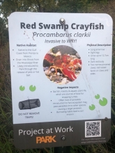
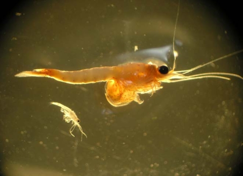
Combining intensive trapping and largemouth bass introduction to control red swamp crayfish
Recently, a small pond in the region was invaded by red-swamp crayfish (Procambarus clarkii). The private pond has no piscivorous fish present. This location has been under active management using intensive trapping for 3 years, with some initial suggestions of reducing the population size of red swamps. To add to this effort, 20, 10-12 inch largemouth bass were introduced into the system in spring 2025. We will continue to monitor crayfish population response to this introduction.
Native crayfish culturing
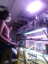
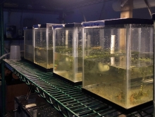
Competitive niche replacement occurs when one species having a large degree of niche overlap with similar species outcompetes rivals in an area. This outcome may be more prevalent following a species invasion. Locally, red swamp crayfish have invaded two locations in western NY and are becoming the dominant species in the two habitats. Research suggests that native crayfish populations might be able to remain dominant in their local habitats if their population size is large enough. We are creating a laboratory culture of native White River crayfish (Procambarus acutus acutus) for potential release to locations where they have been on the decline since the arrival of red swamp crayfish as a management tool to assist native population decline.
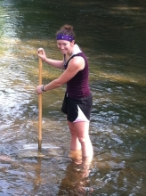
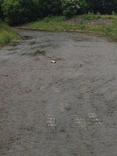
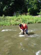
Invasive fish effect on stream drift rates
Stream drift is a phenomenon linking upstream reaches to downstream reaches through the flow of energy and nutrients as benthic organisms relocate downstream. Amphipods and midges constitute the bulk of drifting organisms in streams of western NY. We are investigating drift rates in streams of the region with and without invasive round gobies present. Preliminary work suggested amphipod drift rates were diminished in streams with gobies compared to stream without gobies. This research is a follow-up to those preliminary studies.
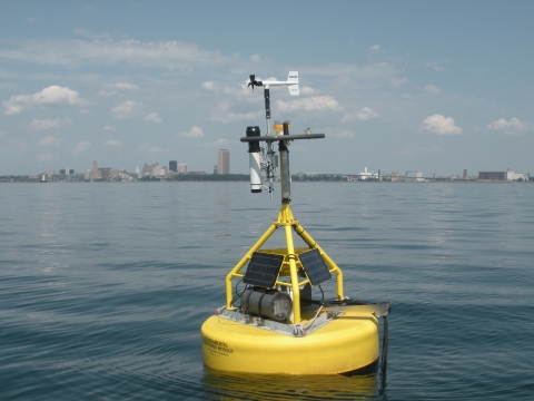
Implementation of the Great Lakes Observing System
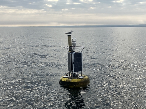
Since the summer of 2011, we have deployed an automatic buoy provided by GLOS (Great Lakes Observation System) into Lake Erie. The buoy is maintained and run through the Great Lakes Center as a part of a regionally distributed network of 19 fixed monitoring buoys that are located throughout the five Great Lakes. The buoy is one of six standard GLOS buoys and the only one located in the Eastern basin of Lake Erie.
The GLOS buoy is deployed 5 miles NNW of Dunkirk in 30 meters of water. The buoy is 16 feet in length, 4 feet in diameter and weighs a little over 650lbs. It collects meteorological information including solar radiation, barometric pressure, wind speed and direction, and relative humidity, as well as wave height, direction and period information. The buoy also measures water temperature from the surface to 20m in depth, and dissolved oxygen and conductivity at 20m. Data collected are logged and transmitted via a cellular link back to the Great Lakes Center. The information collected from this buoy and from the whole GLOS system can be used for climate modeling, lake current and energy budget modeling, as well as being useful for the study of nutrient dynamics and fisheries. The system is also useful for commercial and recreational navigation by providing real time information regarding wind and wave conditions.
In the summer of 2012, buoy evidence was used to help explain a fish kill.
We received another year of funding to operate the eastern Lake Erie Buffalo State/Great Lakes Observing System (GLOS) buoy, including $5,009 for salary recovery and associated fringe costs. Continued success in funding is a result of the fact that we have reliably operated buoys for the GLOS network since 2012. Our buoy is the only GLOS buoy operating in eastern Lake Erie, making it an important source of information for a variety of stakeholders. The GLOS buoy is gaining in popularity and, once again, we expect over 20,000 visits to the GLOS website by users looking to see lake conditions and our buoy data are regularly included on Channel 4 Television News weather reports. Recent efforts to expand the user base are proving successful. We have been strengthening our relationships with the users in the Western New York Community, such as the many charter captains who utilize this buoy for planning purposes. In addition, the Dunkirk Buoy is currently being added to the National Data Buoy Center, which will help the National Weather Service with forecasting models.
News article: Awards: September 2010; Top-Notch Research Leads to Increased Funding, More Projects at Great Lakes Center; Six GLC Posters Presented at Annual Fall Forum; Newsletter #1: Great Lakes Center Buoys; Newsletter #1: View from the water's edge; Newsletter #1: Buoy evidence may explain summertime fish kill; Newsletter #17: Popular GLOS buoy receives an upgrade; Newsletter #23: Field Station Snapshots; Newsletter #25: Dunkirk Buoy named 'Buoy of September'; Newsletter #25: Happy Retirement, Mark!; Environmental Monitor: Monitoring Lake Erie’s Eastern Basin: Building Long-Term Data and Real-Time Public Solutions; Achievements: Brian Haas, Field and Lab Research Technician, Great Lakes Center; Five things to know about Buffalo State's Great Lakes Center; Newsletter #27: Happenings at the Field Station; Environmental Monitor: Buffalo’s New Data Buoy Tracks Lake Erie’s Extreme Weather; Newsletter #28: New Buffalo buoy updates; Dunkirk Observer: Federal cuts spill into lake monitoring; Buffalo News: New weather buoy coming to Lake Erie a 'no-brainer'; Achievements: Brian Haas, Field Station Manager, Ben Szczygiel, Research Technician, Great Lakes Center; Faculty/Staff Achievements Roundup: Thering receives SUNY Online Effective Practice AwardFaculty/Staff Achievements Roundup: Thering receives SUNY Online Effective Practice Award; Your May Update from the Great Lakes Observing System: The Buoy(s) of May, Buffalo State University - Dunkirk and Buffalo Buoys
Photo galleries: First deployment of the buoy; Old method for deploying the GLOS buoy; Low water affects boat launching in Dunkirk; Deploying the GLOS buoy; Retrieving the buoy 2018