Great Lakes Center Newsletter: Issue 25
November 8, 2024
This issue features a workshop hosted by the Great Lakes Center for the New York State Master Teacher Program, our Dunkirk Buoy being chosen as GLOS's buoy of the month in their newsletter, our fieldwork on Lake Erie and the other Great Lakes, the importance of coupling invasive species management with native plant restoration, using Landsat images to track algae blooms in Lake Erie, and the retirement of our field station manager.
GLC workshop for Master Teachers
by Dr. Chris Pennuto
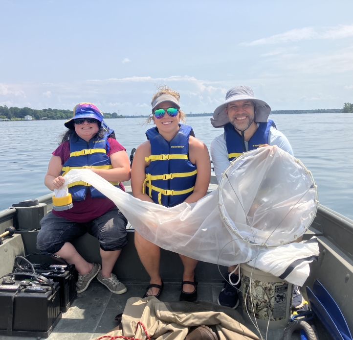
Upper Niagara River.
The Great Lakes Center offered a summer workshop for the Master Teachers Program in July. The New York State Master Teacher Program is an active professional network of more than 1,400 outstanding public school K–12 STEM educators who serve as mentors for early career STEM teachers and teacher candidates. Noted for its faculty expertise and outstanding educator preparation programs, Buffalo State was one of just four campuses chosen for the Master Teacher pilot program when it launched in 2013. For the past decade, the college has continued to serve as the Western New York regional programming hub, now one of nine in the state.
This past summer, 14 Master Teachers from across the state completed a 4-day workshop with hands-on training in a variety of Great Lakes topics, instructed by personnel from the Great Lakes Center and Biology Department at Buffalo State, plus the Biology Department at Canisius University. Dr. Chris Pennuto (GLC & Biology) assembled the team of presenters and coordinated the week of activities. On the team were Drs. John O’Brien (Canisius, zooplankton/phytoplankton), Robert Warren (Biology, climate change), Randal Snyder (Biology, fisheries), Olga Novikova (Biology, environmental microbiology), and Alexander (Sasha) Karatayev (GLC, invasive species). GLC field station interim manager, Brian Haas, joined us during the field portion, operating a boat to get participants out on the Niagara River for zooplankton collections. This location on the river is easily accessed, and since it is within sight of Lake Erie, the zooplankton counts and community composition are reflective of eastern Lake Erie.
The workshop split time between laboratories on the main campus, the Great Lakes Center Field Station, and field sites at Beaver Island State Park. It covered topics in stream and river biomonitoring, zooplankton community identification, microbial community functions, Great Lakes fish primer, discussions on climate change impacts to the Great Lakes region, and status of aquatic invasive species. Participants can now take those skillsets and topics back to their home school districts to enhance statewide understanding of these aspects of the Great Lakes. Participating staff and faculty had a great time with the teachers and look forward to more workshops in the years ahead.
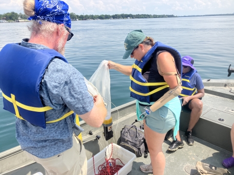
Upper Niagara River.
Dunkirk Buoy named 'Buoy of September'
by Susan Dickinson, Kit Hastings, and Brian Haas
The GLC–operated Dunkirk Buoy was recently named the Buoy of September! Since 2011, the Great Lakes Center has operated and maintained this buoy off the shores of Dunkirk, New York, in Lake Erie as part of the Great Lakes Observing System (GLOS).
The buoy’s sensors measure meteorological and wave conditions, water temperature in 2-meter intervals to 25m, and dissolved oxygen and conductivity at 25m. The information collected can be used for climate modeling, lake current, and energy budget modeling as well as for the study of nutrient dynamics and fisheries. It is also helpful for commercial and recreational navigation by providing real-time information regarding wind and wave conditions. Buoy data can be viewed on Seagull.
GLC Field Station staff members remove the seasonal buoy from the lake in early fall for any needed maintenance and to protect it from harsh Buffalo winters and redeploy in the spring. Both deployment and retrieval of the buoy are weather dependent. The Dunkirk Buoy was retrieved for the season in early October when Brian Haas hired Ben Szczygiel (former Biology graduate student) and Emily Klimczak (current GLES graduate student) to help him safely retrieve it.
The GLC is thrilled to be recognized for its efforts in managing this valuable resource.
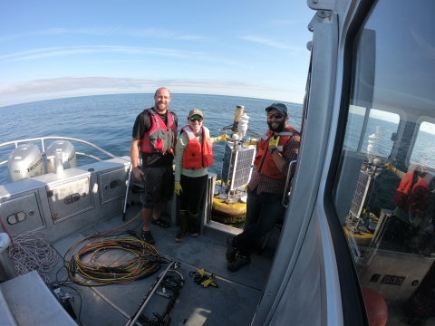
early October.
Exploring Lake Erie: Great Lakes scientists conduct CSMI survey
by Susan Daniel, Lyubov Burlakova, Alexander Karatayev, and Nikolai Barulin
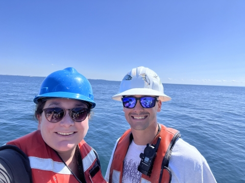
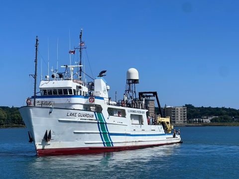
In July, a team of scientists from the GLC boarded the R/V Lake Guardian in Cleveland, Ohio, to conduct the Cooperative Science and Monitoring Initiative (CSMI) benthic survey on Lake Erie, following previous surveys in 2014 and 2019. During the survey, there was a happy reunion with former GLC student employee and GLES alumnus, Josh Allan, a relief Marine Technician for the Lake Guardian. Josh had helped process benthic samples at the Great Lakes Center from September 2018 until his graduation in 2020. We were reminded of his stellar work ethic and positive demeanor as he assisted us with sample collection.
During the week-long survey, Alexander Karatayev, Lyubov Burlakova, Nikolai Barulin, and Susan Daniel aimed to collect over 200 samples from 77 locations. The focus this year was to monitor the benthic fauna, particularly the quagga mussels (Dreissena rostriformis bugensis) and zebra mussels (Dreissena polymorpha) that have altered the lake environment over the past 30 years. In addition to traditional sampling methods, video recordings of the sediment surface were used to gather near real-time information on quagga and zebra mussel distribution, revealing a possible decrease in their abundance. However, this finding will be verified with traditional methods, as video recordings may underrepresent areas with low visibility and small mussels.
Other research questions were also explored during this CSMI survey. Professor Yvonne Vadeboncoeur and graduate student Ahmed Ogidan from Wright State University collected algae to quantify differences in algal communities inhabiting soft sediments and growing attached to dreissenid mussel shells across depth gradients in Lake Erie. A separate team from the National Oceanic and Atmospheric Administration, including Paul Glyshaw and Rachel Orzechowski, examined morphological and reproductive changes in quagga mussels across different depths and food gradients.
Lastly, sediment core samples were collected by two Canadian research teams. One team from the University of Toronto, including Maria Dittrich, Khoren Avetisyan, Ms. Kajal, and Zach Diloreto, measured oxygen, pH, redox, nutrients and organic carbon in porewater and different sediment layers. These samples, although difficult to collect from hard substrates like rocks, gravel, and sand, will help us understand how quagga mussels altered the sediments and sediment-water interface. The results will be modeled with AQUSIM to calculate carbon mineralization rates and nutrient retention. Researchers from the University of Waterloo, Serghei Bocaniov, Stephanie Slowinski, Kayla Martin, and Tia Jenkins, focused on biogeochemical dynamics and carbon mineralization at the sediment-water interface. Their work will explore historical relationships between sediment phosphorus concentrations and various stressors, such as climate change, land use, watershed-based phosphorus inputs, lake productivity, dreissenids, and shoreline erosion.
As the CSMI continues to unravel the complex interactions within Lake Erie’s ecosystem, our collaborative efforts will shed light on the dynamic changes occurring beneath the surface. The findings from this survey will enhance our understanding of how invasive species and environmental stressors impact the lake and also provide critical insights that will inform future conservation and management strategies.
GLC successfully completes another summer survey
by Lillian Denecke
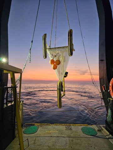
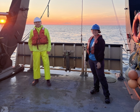
The GLC took part in another year of sampling during the summer survey aboard the R/V Lake Guardian this past August as a part of the Great Lakes National Program Office Biology Monitoring Program. The sampling cruise was completed on time again this year, with only a couple minor delays for weather. A total of 186 benthic samples were successfully collected from 62 stations by Nikolai Barulin, Mimi Byrne, and Lillian Denecke. This year, scientists on board the ship had the opportunity to share with the public what life is like on the ship and what type of research is done, as public tours were given at port stops in Detroit, Rochester, and Sault Ste Marie.
Nikolai and Lillian flew to Milwaukee, Wisconsin, on July 31st to board the ship with many researchers from other institutions and prepare to depart for sampling the following morning. The first leg of the survey covered lakes Michigan and Huron. During this leg, Nikolai and Lillian assisted researchers from University of Minnesota Duluth with their research by collecting Dreissena samples with the benthic sled. The samples will be analyzed for PFAS as part of a master’s thesis project. In Lake Michigan, the ship took a detour into Muskegon Lake to collect a sediment core, which was an exciting diversion.
After a port stop in Detroit with public tours, both Nikolai and Lillian stayed on board for the second leg of the survey on lakes Erie and Ontario. During the sampling of Erie, waves became rough which resulted in a 24-hour port stop in Cleveland, where everyone was happy to stretch their legs and explore the city while the weather subsided. Once the weather improved, the survey continued with the rest of Lake Erie, a quick trip through the Welland Canal, and then Lake Ontario. In Lake Ontario, another sediment core was collected in Henderson Bay at the eastern end of the lake. Leg two ended in Rochester where Nikolai departed, and Lillian stayed on for the final leg.
The final leg of summer survey was in Lake Superior. The ship traveled back through the Welland Canal and through lakes Erie and Michigan to Sault Ste Marie where Mimi Byrne flew to meet the ship and board. Lillian and Mimi sampled the last lake of the survey and enjoyed the views on Lake Superior, from the millions of stars to the wildernesses on the north shore. The ship stopped in Superior, Wisconsin, halfway through the final leg. On the way back towards Sault Ste Marie, the ship anchored for a few hours in remote Heron Bay along the northern shore to wait out some inclement weather. While Lillian spent the whole time looking for moose, unfortunately none were spotted. The ship arrived back in Sault Ste Marie on August 29th. Lillian and Mimi were incredibly grateful for Susan Daniel for coming to pick them and the samples up to transport back to Buffalo. They enjoyed a scenic ride through Ontario, Canada, along the northern shore of Lake Huron before arriving back in Buffalo after another successful summer survey.
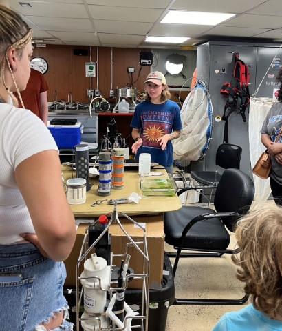
in Detroit. (Credit: Elizabeth Hinchey Malloy)
Invasive species management and native plant restoration go together like fall and pumpkin spice
by Rachel Taylor
2020.
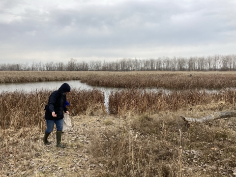
Native plant restoration is a necessary step for ensuring invasive species management efforts are successful. Re-establishing diverse, native plant communities creates habitat that is more resilient against invasive species and helps restore interactions between native plants and wildlife, which is essential for an ecosystem to function properly. Of course, it isn’t as simple as removing the invasive species and planting native ones. A lot more goes into developing and implementing a management and restoration plan.
The first step is to understand what you have at your site. This can be accomplished by completing a site inventory including collection of presence and distribution information on invasive and native plants and animals, identifying soil types, and mapping out potential invasive species source populations and pathways of invasion. Once those building blocks are established, you can move forward with developing your goals, objectives, and performance metrics, preparing a management plan, developing and initiating a monitoring program, and finally, implementing your plan. Over time, be sure to document what happens at the site, maintain all your records and periodically re-evaluate your program.
It’s important to keep in mind that site conditions can vary widely and thus, so can the amount and type of work involved. You may be starting with a site that is in relatively good condition, meaning that a native plant community is already established, and the area has low invasive species cover and external pressure. In this scenario, once you remove the invasive species, you may find that the native plants respond by filling in those areas on their own and active restoration isn’t necessary. However, you may still choose to bolster the native plant community by adding to the species diversity and in turn, increasing the site’s resilience against future invasions.
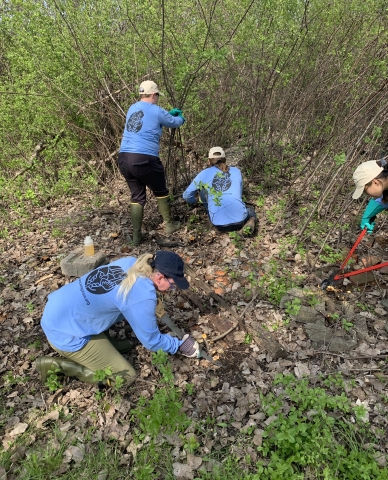
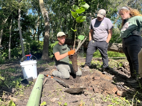
While it is great to maintain and improve higher quality areas, we often find ourselves managing highly degraded sites with significant invasive species cover. Working in these areas requires a bit more patience and elbow grease. Invasive species should be removed using best management practices, typically for about three years, before starting to restore native plants. Adding native plants too early can make management efforts more challenging and is often less effective, since the invasive species haven’t been completely removed yet and will re-emerge within the newly planted areas. Native plants are unable to outcompete well established invasive species infestations, whether restored through plugs or seed, and they need your help by addressing the invasives first.
Remember that no matter what type of site you begin with, both invasive species management and habitat restoration will require continued monitoring and management, although the effort involved will likely decrease over time. The best time to start monitoring is before the onset of work as it will provide baseline data for the site and will help you to better track results, but the second-best time is now! It’s important to regularly monitor and remove invasive species as they emerge to avoid undoing all your efforts. It’s also important to monitor restoration plantings and bolster them when appropriate to ensure your site remains resilient.
Finally, don’t forget to share what you’ve learned throughout the process! We are all in this together and can learn a lot from each other’s successes and failures! If you have a site that’s ready for restoration, fall is the perfect time to get started! Check out WNY PRISM’s Best Management Practices for Restoration Seed Mixes (PDF) for guidance on species selection, planting strategies and more!
Originally appeared in the WNY PRISM Fall 2024 Newsletter. Republished with permission. All photos credited to WNY PRISM.
Applying satellite images to study environmental issues for Lake Erie
by Dr. Tao Tang, GLC Affiliate
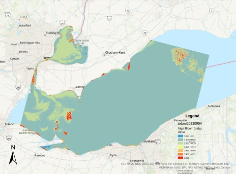
sampling data on 9/4/2023.
Dr. Tao Tang of the Geosciences Department spent most of his summertime in 2024 conducting research applying Landsat remote sensing data to identify areas and digitally map algal blooms in Western Lake Erie during the last ten years (2013 to 2023).
The Landsat program was established by US National Aeronautics and Space Administration (NASA) in 1972. Since then, a series of Landsat Earth observation satellites have been launched, from Landsat 1 to Landsat 9 today. It is the first scientific Earth surface observation system humans ever built. Currently, we have both Landsat 8 and Landsat 9 in space orbiting the Earth to collect Earth observation data every day. The US Geological Survey (USGS) operates the Earth Resources Observation and Science (EROS) Center that oversees downloading, archiving, and disseminating both current and historical data of satellite images.
According to Dr. Tang, “This is a treasure box for the data of big pictures to study the global environmental change in general and environmental change in the Great Lakes region in particular.” Most of the historical treasures of Landsat satellite images in the Great Lakes region have not been explored scientifically yet. Dr. Tang’s current research is to formulate a mapping index model, analyze, and present the spatial and temporal distributions of algal blooms in Western Lake Erie from 2013 to 2023. A total of 59 Landsat satellite images were used for this research.
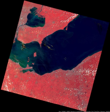
(downloaded 8/11/2023).
Happy retirement, Mark!
by Brian Haas
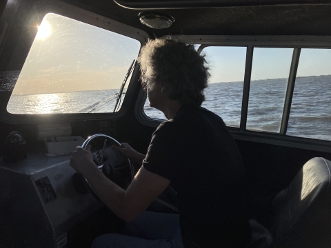
western basin of Lake Erie.
Field Station Manager and Research Scientist Mark Clapsadl retired this past August. Mark joined the GLC in 2006 and brought with him a wealth of nautical knowledge and years of experience working in large freshwater and marine environments. His expertise was vital for carrying out numerous research projects and his unique combination of problem-solving ability, mechanical skills, and ecological insight made him an invaluable component of countless field efforts. One of his most notable achievements was the reliable deployment and operation of the Dunkirk Buoy for the past 12 years as part of the Great Lakes Observing System (GLOS). This has created a valuable long term data set and has provided dependable real-time water and weather conditions to local boaters in the region.
During his career, Mark made many significant contributions to the Field Station. He was instrumental in assembling and maintaining the modern fleet of research vessels that have been used to win grants and conduct research across the Great Lakes. He initiated and oversaw numerous upgrades and renovations to the Field Station and its grounds, including a large-scale dock and boat launch rebuild. Mark also secured funds to add habitat enhancements to the waterfront property including native plant gardens, that will continue to grow and provide benefits to wildlife for years to come.
Mark worked with many graduate students over the years and helped them to build a foundation of skills needed for careers in the aquatic sciences. His good-natured humor and broad knowledge on a variety of subjects made him a wonderful mentor. He always put safety first and foremost and took great care to make sure everyone he worked with was safe and well prepared. I worked with Mark on the water for the last 7 years and no matter the unexpected challenges that arose, I was always confident that we would complete the task at hand. He is a true friend and his presence at the GLC will be missed. I, along with the entire GLC, wish Mark a healthy and happy retirement!
