Great Lakes Center Newsletter: Issue 19
November 15, 2021
This issue focuses on the return to field sampling after the COVID-19 pandemic, graduate student research, and activities at the Field Station, including the first purple martin fledglings in our housing structure.
The GLC returns to the R/V Lake Guardian
by Susan Daniel, Lyubov Burlakova, and Alexander Karatayev
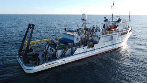
(Photo credit: Vadim Karatayev)
Researchers were finally able to return to sampling all five Great Lakes as a part of the Great Lakes National Program Office (GLNPO) Biology Monitoring Program after a year-long hiatus in 2020 due to the COVID pandemic. Operations were anticipated to be “business as usual” with a few additional health and safety protocols including the requirement of a COVID-19 vaccination and a ship-wide negative PCR result. The ship was set to sail out of Milwaukee, Wisconsin on August 2nd, but the cruise was delayed due to unforeseen engine trouble shortly before leaving dock. The extent of engine trouble was revealed and subsequent delays grew until finally alternative plans needed to be made. Luckily, there are other research vessels throughout the Great Lakes. Samples from Lakes Erie and Ontario were graciously collected and coordinated by collaborators at GLNPO, Great Lakes Laboratory for Fisheries and Aquatic Sciences (Fisheries and Oceans Canada), Great Lakes Science Center (USGS), Cornell University, and our very own Mark Clapsadl and Brian Haas.
The survey of the remaining lakes was finally resumed in early
September in lieu of the scheduled Cooperative Science and Monitoring Initiative (CSMI) Lake Superior survey, which was postponed until the 2022 field season. Lyuba Burlakova, Alexander Karatayev, and Vadim Karatayev (GLC Adjunct research scientist) represented the GLC on the survey of Lakes Michigan, Huron, and Superior.
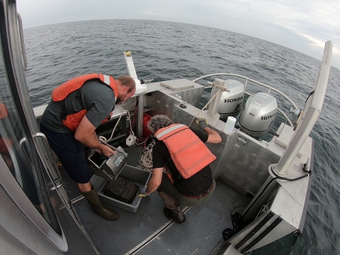
R/V John J. Freidhoff.
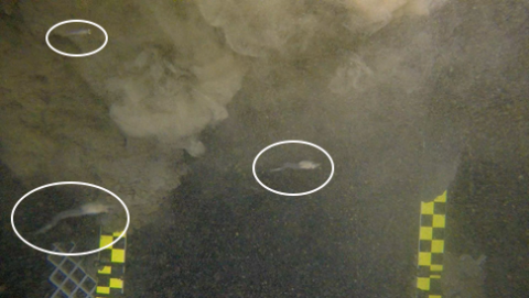
While on this survey, they used the Benthic Imaging System (BIS) to finish the rapid assessment of Dreissena in Lake Michigan, counting dreissenids in pictures cut from video files. Additionally, they were able to beta-test a new method of observing Mysis shrimp, native to the Great Lakes and an important food source for fisheries. The Lake Guardian was battered with bad weather and waves during this whole survey, but remarkably the crew pushed through these hardships and were able to collect samples from all the historic stations, providing crucial data after the gap created by COVID-19. Vadim used his small drone to record the Lake Guardian under way and during sampling, providing unique shots of the ship from above.
These surveys and subsequent data are used by managers and scientist throughout the Great Lakes basin to guide legislation, best management practices, and innovative research. We are indebted to the community of researchers who banded together and aided in gathering these invaluable samples during these trying times. We hope that the Biology Monitoring Program will be returned to normal and visit all five Great Lakes during the month of August in 2022.
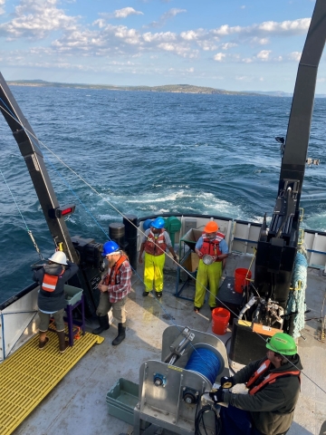
R/V Lake Guardian.
Alternative work ending as 2021 benthic samples begin to be processed
by Susan Daniel, Erik Hartnett, Kit Hastings, and Brianne Tulumello
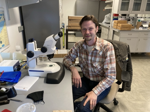
Although discomforting for scientists who like things to go as planned, these past two years were like an old friend that we didn’t know we needed to see. Due to the COVID-19 pandemic and subsequent shutdowns, we were unable to collect samples for the Great Lakes Biology Monitoring Program in 2020, resulting in a decrease in work for our staff. To remedy this unforeseen break between samples, EPA’s Great Lakes National Program Office (GLNPO) and the GLC worked closely together to create an alternative work plan that could benefit the benthic program. There were three main tasks detailed in the following sections. The work is ending now that sampling operations have restarted and we were able to collect new benthic samples in 2021.
Photo gallery: GLC Alternative Work Plan 2021
Inventory and Archival of Historic GLNPO Biology Monitoring Benthic Samples
In 1997, GLNPO added the collection of benthic macroinvertebrates to the Biology Monitoring program. Once these samples are collected and identified, organisms are preserved with ethanol or mounted on slides and stored for future use. The stored samples should be revisited every few years to refill preservative and inspect their condition. Missing the collection of the 2020 samples meant we had a rare opportunity to do a complete inventory and archive all samples. This was truly a team effort!
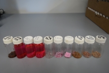
poor condition.
Erik Hartnett and Brianne Tulumello described the current state of each vial and microscope slide collected from 1997 to 2019, as well as all inhouse Cooperative Science and Monitoring Initiative (CSMI) archived samples (2012-2019). 18,538 vials and 17,122 slides from 1997 to 2019 were inventoried. Erik noted the 1997 vials were in overall poor condition, but out of the 870 vials inventoried for 1998 and 1999, the majority were preserved well. Brianne inventoried historic 1997-1999 slides, which was an involved and tedious process. To take an accurate inventory on the sites, counts, and condition of the slides, Brianne had to delicately separate some slides that were stuck together. Many of the 1997 slides were in poor condition, making the data hard to compare with records, while slides from later years were in much better condition.
Another unfortunate finding was that many sample slides we mounted in 2019 for CSMI Lake Erie had to be redone. To identify the many species of Oligochaeta and Chironomidae, specimens must be permanently mounted on microscope slides using a mounting media known as CMC. After a change in the formula of CMC from the manufacturer, it became apparent that most of the slides mounted for the 2019 sampling season had quickly begun to degrade. Over time, the exposed organisms would deteriorate and become unidentifiable if left unabated. This resulted in nearly 1,800 slides needing to be remounted to preserve the sample integrity for future use. Additional methods were developed to better understand the new CMC formula and to use different mounting media to reduce future slide failures, as well as reaching out to the manufacturer to find a formula to better meet our mounting needs.
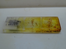
fused together and Brianne had to
carefully separate them.
The Reexamination of the Early Years 1997-1999
When designing a new sampling procedure, there are bound to be some problems and lessons learned along the way; the early years of the GLNPO Biology Monitoring Program were no different. By statistically comparing data from the early years, we found that the 1997-1999 samples seemed to be identified somewhat differently than the subsequent years. To remedy this, we first verified that the records matched physical samples, and then identified major taxa to higher taxonomic resolution used in later years. In these early years, organisms were sometimes identified to genus instead of species, and we re-identified the same organisms to species level. Unfortunately, many organisms were missing or lost from samples collected in 1997, in contrast to samples collected in 1998 and 1999. This October, our laboratory submitted the corrections to GLNPO, and the data are currently in review. We are very grateful for the opportunity to reexamine these samples and data, which were preserved by GLNPO for over 20 years! This improvement will greatly increase our understanding of long-term trends observed in the Great Lakes.
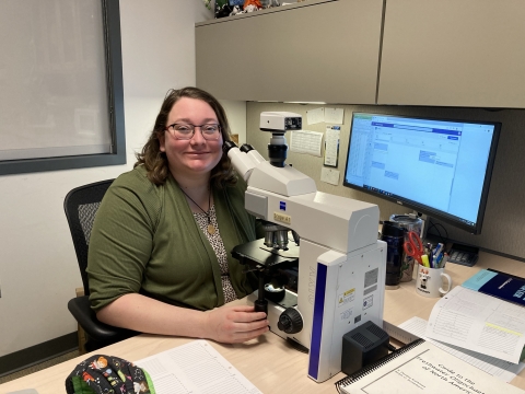
taxonomic resolution.
GLNPO Benthic Invertebrate Reference Guide
Kit Hastings worked with Susan Daniel to create an image database for all Great Lakes species identified during the GLNPO Biology Monitoring Program. Kit focused first on the 59 oligochaete species found in our samples, writing up descriptions that highlight the distinguishing features of each species, other similar species that it could be confused with, and whether there is a genetic barcode reference from the Great Lakes in the BOLD database. So far, there are 21 Great Lakes oligochaete species profiled in the Great Lakes Benthic Invertebrate Reference Guide, along with pictures showing the distinguishing features that were taken by Susie during the Barcoding grant. As we move forward with our new 2021 samples, Kit and Susie will take pictures of relevant features to help add to the Reference Guide in the future, and eventually add other taxonomic groups like Chironomidae and Unionidae.
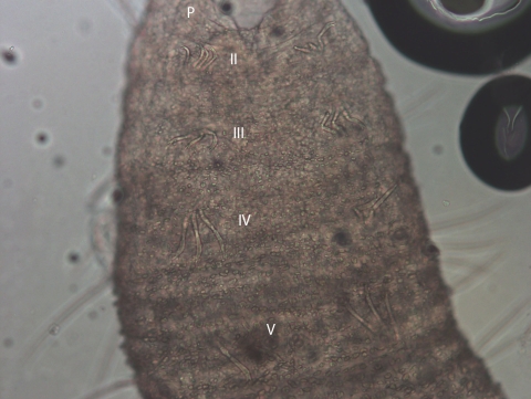
Susan Daniel with labels added by Kit Hastings.
2021 GLC Open House
by Kit Hastings
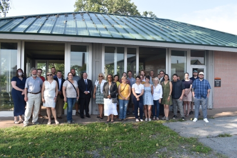
On August 26th, the GLC was once again able to host an Open House down at the Field Station. The 2020 GLC Open House was cancelled due to the COVID-19 pandemic, but now that classes have resumed in-person and all remote employees have returned to campus, the Open House could happen this year. The beautiful weather cooperated to allow us to have a well-attended event with refreshments and a lively discussion of GLC achievements in the 2020-2021 academic year.
Mesocosms, Snails, and Predation Effects
by Kira Yerofeev, Biology graduate student
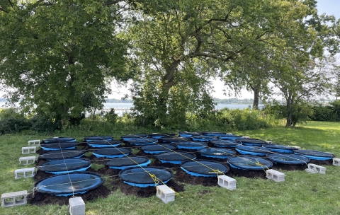
With summer over, so is the goby/snail mesocosm study conducted by Biology graduate student, Kira Yerofeev. The general question addressed in her project was “Do novel and native predators influence detrital cascades equally?” Snails have some remarkable predator avoidance behaviors documented in the literature. For example, several species adjust their locations differently when faced with different predators, such as crawling up plant stems (and even leaving the water) when crayfish are present, but crawling down and into the substrate or under refuge when water-column fish are present. These avoidance behaviors have the potential to affect leaf litter breakdown by reducing overall snail grazing time. Her mesocosm research examined if these behavioral responses are hard-wired to taxonomic units (i.e., avoid crayfish with one method and avoid fish with another), or if the responses are more flexible. She used non-native round gobies, a benthic-feeding fish as an alternative to a pelagic-feeding fish to determine if snails crawled down (the typical response to fish predators) or up (the typical response to benthic predators, like crayfish). Thirty mesocosms were established for a 30-day trial. The tanks held either two round gobies, two crayfish, one goby and one crayfish, or no predators. Snail positions in the tanks were documented every three days and leaf pack decomposition rate was followed over the course of the trial. Although data analysis is on-going, early observations suggest that snails did not recognize round gobies as dangerous and were quickly eliminated from all the mesocosms where gobies we present. It remains to be seen if the loss of this key community member will translate into a change in leaf decomposition rates.
Lake Michigan benthos sampling
by Allison Hrycik
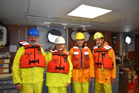
on the Lake Guardian.
In July, a team of four GLC scientists (Allison Hrycik, Sasha Karatayev, Lyuba Burlakova, and Erik Hartnett) traveled to Lake Michigan to sample on the EPA’s R/V Lake Guardian as part of the Cooperative Science and Monitoring Initiative (CSMI) along with several EPA researchers, crew members, and collaborators. We sampled benthic invertebrates at 99 stations after missing one station due to large waves that led us to seek refuge in the port of Manitowoc, Wisconsin for a night. We saw a familiar face when we met up with the ship’s crew: Josh Allan, a GLES program alumnus (M.S. 2019), is now working as a marine technician on the Lake Guardian and was a great help in sampling efforts.
In addition to our standard Ponar grabs to collect benthic invertebrates and assessment of water column conditions with a CTD probe, we estimated Dreissena populations across Lake Michigan by applying technology perfected in the 2019 Lake Erie CSMI survey. We took drop-down camera images at each station, then counted dreissenid mussels in the images. By the end of the cruise, we finished counts and were able to produce a map with preliminary Dreissena density estimates for the entire lake. Although Dreissena are extremely abundant in Lake Michigan and were found at 93% of the stations we sampled, densities appear to have declined since the last Lake Michigan CSMI survey in 2015. This decline can be at least partially due to underestimation of very small (<5 mm) mussels on videos compared to Ponar grab data. However, it is also possible that Dreissena population in Lake Michigan continues to decline. For example, Dreissena average density in 2015 was 1.8-fold lower than in 2010. Statistical significance of this decline will be tested after we process Ponar samples.
We were joined on the cruise by several collaborators working on independent research. Beth Whitmore and Taylor Herne from Cornell collected meiobenthos (cladocerans, copepods, and ostracods) and Mysis shrimp. Paul Glyshaw from the National Oceanic and Atmospheric Administration (NOAA) sampled Dreissena to determine mussels’ length-weight regressions and reproductive status. We also collected pelagic zooplankton samples for stable isotope analysis by Willie Fetzer of the University of Wyoming. All-in-all, it was a busy, productive sampling cruise, and we were happy to have samples to bring back to our GLC lab again.
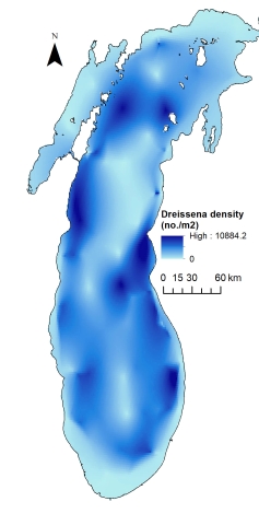
density (number of Dreissena per m2,
preliminary estimations based on
video surveys) that was produced in
near-real time during the cruise.
Further explorations on Starry Stonewort
by Alexander Krest, GLES M.A. graduate student
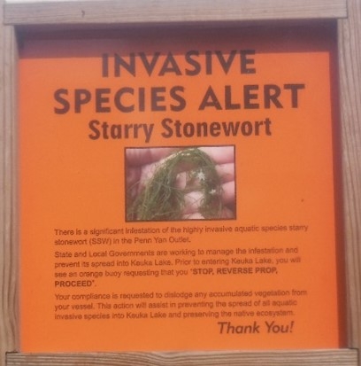
Keuka Lake.
In last fall's newsletter, I offered an overview of the invasive macroalgae Starry Stonewort (Nitellopsis obtusa), its potential threat to WNY waterways, and our research plans moving forward. I’m happy to tell you that since that point I’ve taken a deep dive into finding out what might be some of the possible ecological impacts associated with this unique invader in Western New York.
As the previous article described, this whole project started with a chance discovery of starry stonewort within Burnt Ship Creek on Grand Island, the first documented discovery of the species in Erie County. After detection, we surveyed the rest of Grand Island and mapped its presence (Burnt Ship Creek/Woods Creek). From there, with the help of lab members and advisor Dr. Pennuto, I returned to the mouth of Burnt Ship Creek and collected 5 macroinvertebrate samples from monotypic stands of the invasive starry stonewort, a native macrophyte Canada waterweed (Elodea canadensis), and a native macroalgae, muskgrass (Chara sp.) (15 total samples). The goal of this preliminary survey was to assess whether starry stonewort stands held different macroinvertebrate assemblages when compared to stands of native macroalgae and macrophytes, with a particular interest on macroinvertebrate richness, abundance, and functional feeding group composition.
After the data was processed, I found no significant difference in macroinvertebrate richness or abundance between the three vegetation types (ANOVA not significant), although starry stonewort stands had lower genera richness than the other plant types and a greater mean abundance. Comparison of functional feeding group abundances suggested that there was a significant difference between Elodea and the macroalgae macroinvertebrate communities.
These preliminary findings led to a larger survey across five sites, sampling across a gradient of dominance by Starry Stonewort within each site. Sites range from Grand Island to Syracuse. I am also incorporating a lab study to investigate the possible impacts of starry stonewort on the reproductive capabilities and feeding rates of two target macroinvertebrate types (snails and amphipods). The second portion of my thesis, evaluating Starry Stonewort as a reproduction inhibitor or food resource will take place in the lab as a surrogate to winter surveys in natural settings.
I’m currently in the process of completing this thesis work and things are looking good so far. I hope that by the time the spring rolls around I’ll not only have some more definitive results into the ecological impacts posed by this invasive macroalgae, but also a project that provides a foundational piece of academic work for further research on the ecological impacts of this invasive macroalga.
Photo gallery: Studying invasive starry stonewort
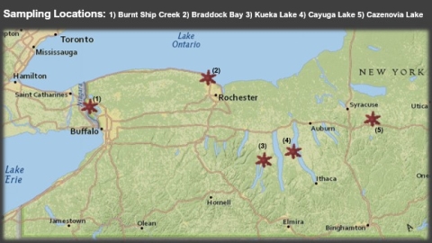
along with neighboring number that corresponds with the site name.
The potential of GIS to visualize and map Sewage Discharge Reports
by Alexander Krest, GLES M.A. graduate student

developed by Alexander Krest.
Combined sewer overflows (CSOs) and sanitary sewer overflows (SSOs) are detrimental events that may release hundreds of millions of gallons of untreated and partially treated sewage into WNY waterways. These discharges pose a multi-dimensional threat, impacting local economies, regional ecology, and public health. Unfortunately, despite a couple highly publicized events, there is still a lack of attention paid to this issue. In 2013, New York State passed the Sewage Pollution Right to Know Act (SPRTK), which requires publicly owned wastewater treatment facilities to report discharges of untreated or partially treated sewage to the DEC. While this legislation is a step in the right direction, the sheer number of incidences coupled with varied reporting strategies and messy database configuration make the prospects of working with this data quite intimidating. Looking at sewage discharge reports for Erie County for the month of September 2019, this project aimed to gauge the potential of displaying this data through GIS applications for public, municipal, and scientific consumption.
To accomplish this project, I began by gathering data for sewage discharges from the NYDEC’s historical (SPRTK) excel spreadsheet and sorted the information by impacted waterbody. Then, through the creation, collection, and implementation of GIS datasets, I was able to highlight certain areas of interest including public boat launches, public fishing access points, responsible wastewater treatment facilities, and DEC designated critical environmental areas within Erie County.
While I believe that the map turned out cleanly and displayed data in a way that’s easier to digest when compared to the raw data spreadsheet, it is somewhat limited in the scope of true data representation. For example, wastewater treatment plants associated with sewage discharges were displayed instead of the plethora of actual discharge points. Another issue was the large number of available hydrography datasets that each have varying lists of independent waterways and variable lengths of these waterways, making it difficult to get the whole picture.
However, with the threat of sewage overflows to increase based on future climate models, and little near future hope of severely reducing such events, the need to effectively communicate this data will surely grow. The use of GIS in this manner should ultimately aid municipalities and concerned citizens in visualizing sewage discharges throughout their community. This format can also be transformed across spatial and temporal scales to investigate events such as these across the globe (where data is available). What was once a large, almost incomprehensible dataset has been displayed in a relatively easily distinguishable manner, that with continued enhancements, can provide for quick and impactful understanding of a region’s wastewater management situation.
Special thanks to Dr. Tao Tang for his instruction and support.
First purple martins fledged from the Field Station
by Brian Haas
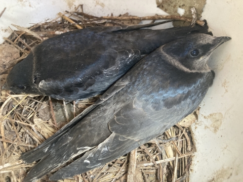
In the waning days of this past spring, the Field Station staff were thrilled to see purple martins at last investigating the housing structure that was erected in the Fall of 2018. The weeks that followed were filled with impressive displays of aerobatics and the distinct sounds of courting purple martins. The result of all this commotion was the construction of a nest followed by the laying of two white eggs, which hatched about 20 days later. The nestlings grew rapidly as both parents hunted and carried insects back to the nest. Approximately 30 days after hatching, the nestlings took flight from their cavity and became the first purple martins to fledge from the Field Station grounds.
Purple martins are the largest swallow in North America and have become almost entirely dependent upon humans for nesting sites across large portions of their range. These birds prefer to nest in large colonies and often show site fidelity, which is why it can be difficult to attract purple martins to a newly established housing structure. While one nest and two fledglings seem a far cry from a bustling colony, it is definitely a very important first step. We are hopeful that the purple martins from this summer will survive their long migration to their wintering grounds in South America and make their way back to the Field Station to breed next spring.
Photo gallery: First purple martin fledglings
Photography field trip at the Field Station
by Brian Haas
Collaboration continued between the Great Lakes Center and the Department of Art and Design this past summer. Yola Monakhov Stockton, who coordinates the Photography Program, worked with Great Lakes Center staff to provide unique opportunities for the students taking her Intermediate Photography course. Students received a lecture on Great Lakes Ecology, followed by a trip to the Field Station and out onto the water, where they worked on their photography projects.
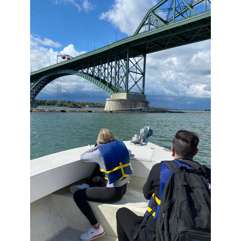
pictures of the Niagara River, Black Rock Canal, and the Peace Bridge.
Looking for a brighter future for lake sturgeon
by Kylie Wirebach, Biology graduate student
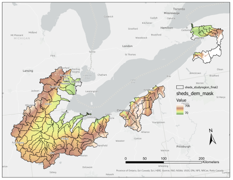
of interest; these data are used to derive a slope layer, which will represent
flow stability, an important habitat parameter for lake sturgeon.
Since compiling a list of Lake Erie tributaries historically used by lake sturgeon (Acipenser fulvescens), Master’s student Kylie Wirebach has begun work on a multiple-scale, multiple-criteria habitat suitability analysis for her thesis work. This project, funded by the U.S. Fish and Wildlife Service, has the goal of quantifying and summarizing the current suitability of historically used watersheds for the potential reintroduction of lake sturgeon, a majorly extirpated species of the Great Lakes.
Using habitat suitability analysis is an efficient and effective way to look at and study landscape conditions without having to physically travel to the field. For tributaries all across the U.S. side of Lake Erie, Kylie has collected spatial data to represent the habitat needs of lake sturgeon across multiple life stages, as well as multiple spatial scales. At the watershed level, several data surrogates will be used: landscape slope to represent stream flow stability, watershed forest cover to represent stream temperature, subwatershed area to represent mainstem stream depth, and developed land cover to represent stream substrate embeddedness, among others. At the smaller scale, the stream reach level, Kylie will adapt spatial data used in the USGS Great Lakes Regional Aquatic Gap Analysis project (McKenna et al., 2014): coarse surficial geology to represent substrate size class, mean July water temperature for breeding-period temperature, and stream order to represent flow stability, among others. These data will be classified on a common scale showing high suitability to low suitability for lake sturgeon, then multiplied by mathematical weights based on relative importance to lake sturgeon success, and finally combined to create a composite map showing areas of high to low habitat suitability at multiple scales. These spatial scales will be compared as a means of validating the analysis model, with the benefit of creating a detailed summary of landscape and stream-level conditions for resource managers and conservation groups. In addition, since multiple watersheds are being assessed, they will be compared to one another to identify priority locales for reintroduction and restoration.
Kylie presented her progress on this thesis project at the Annual Meeting of the American Fisheries Society on November 8, 2021, in Baltimore, Maryland.

