
written by Michael Kalinka and Lindsay Piotrowski, GLES M.S. students
We conducted a GIS-based environmental conservation project for Erie County, New York, in GEG 528 Environmental Assessment and Planning Applications in GIS. This service-learning project was requested by Erie County Parks, Recreation, and Forestry. We were asked to create a digital map identifying eastern hemlock trees in Erie County Parks and Forests. This project will help Erie County combat the spread of Hemlock Woolly Adelgid (HWA, Adelges tsugae), an invasive forest pest posing a serious threat to Eastern hemlocks (Tsuga canadensis), which are a foundational species in the forests of New York State. HWA feeds at the base of the needle leaves and harms the tree’s tissue by impeding the flow of nutrients and water to the end of the twigs. Long term effects would produce the mortality of trees and devastate the northern hardwood ecosystems.
To serve the purpose of protecting the stock of Eastern hemlocks, the Erie County Parks Department charged us to conduct remote sensing-based surveys and produce a detailed digital map of the current distributions of Eastern hemlock trees. Originally, field managers and park rangers thought that the locations of Eastern hemlocks throughout Erie County properties could be determined by classifying the pixel values of vegetation on large scale aerial imageries of New York State orthoimagery. Unfortunately, we were informed by HWA remote sensing research experts at Cornell University that currently there is not a valid method available to differentiate between the similar spectral reflectance shared by evergreens and conifers, such as white pine and eastern hemlock. Hyperspectral imagery is needed for identifying the Eastern hemlock from other tree species as a frontier research project. Multi-spectral images that we obtained are not suitable for this type of species-specific research. Meanwhile, hyperspectral imageries are unavailable in the Western New York region and the data collections are expensive and time consuming. After discussing this issue with Dr. Tao Tang, the co, we hypothesized using soil type and 3D LiDAR datasets as the major criteria identifying Eastern hemlock presence in two experimental areas, Eighteen Mile Creek Park and Boston Forest Conservation Park.
Based on the previous research of Timoney et al. (1993), highly acidic soils that have moderate amounts of fine sand, insignificant amounts of clay, and that are rich in carbon and nutrients, were deemed suitable soils for conifers, including the eastern hemlocks species. After the appropriate areas of hemlock tree growth were confirmed by soil distributions, a follow-up LiDAR analysis was undertaken to determine the likelihood of similar tree distribution, biomass structure (crown), and height (age). This process was based on the analysis of three-dimensional canopy shapes. Our study is the first step to use 3D LiDAR data to identify hemlock trees.
Despite technical limitations, our research demonstrated the possibility of verifying species location and distribution based on geographic variables such as soil type and LiDAR data. The need for more readily available, hyper-spectral imagery is evident, as is the need for greater collaboration between disciplines in preventing HWA from spreading and destroying ecologically vital eastern hemlocks.
*Special thanks to Dr. Tao Tang, professor of geosciences, for technical and academic advisement during this research.
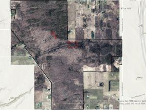
Image caption: A map of Boston County Forest with a few evergreen riparian forested areas highlighted with a red outline near the center part of the aerial image.
Some content on this page is saved in PDF format. To view these files, download Adobe Acrobat Reader free. If you are having trouble reading a document, request an accessible copy of the PDF or Word Document.
